
History

“La Casa Amarilla” the Low Island,
its habitat in Tenerife.

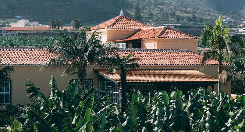
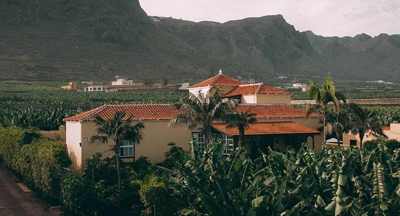
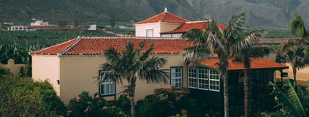
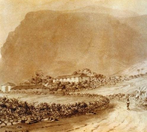
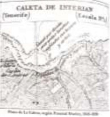
The Casamarilla Rural Hotel is a beautiful two-story colonial-style house that dates back to the mid-19th century, it was built as a room for the owners on a farm that was already registered in 1887 as a rustic farm partly populated with nopales for cochineal, and later in 1904 dedicated to the cultivation of sugar cane and tomatoes. In turn, in the description of the time, he details that there are two other party houses and a building in which there is a steam-driven sugar machine (now disappeared) with the necessary tools for grinding and obtaining sugar, because the situation economy is redirected with alternative crops in the last third of the nineteenth century. It is known by the name of Casa YELLOW and is located in La Caleta de Interián, municipality of the Port of Garachico, being made up of three portions called “Suerte de Correa”, “Pared Doble” and “Gaviotas”, and in addition to a orchard…All of it measures 8 hectares, twelve areas, eighty centiares, which is the same as fifteen bushels or approximately 80 thousand square meters.

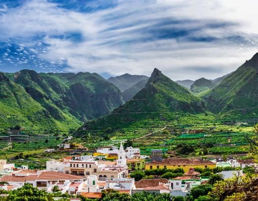
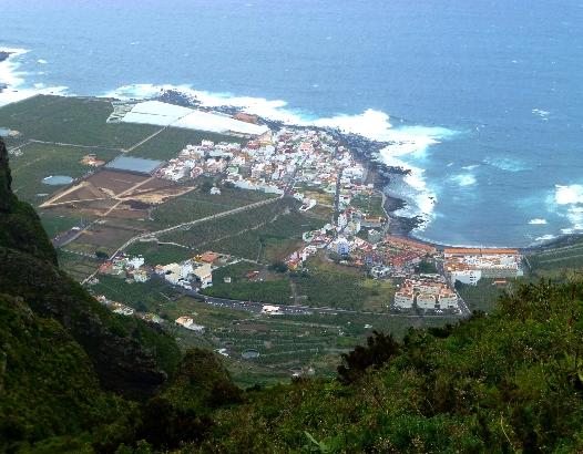
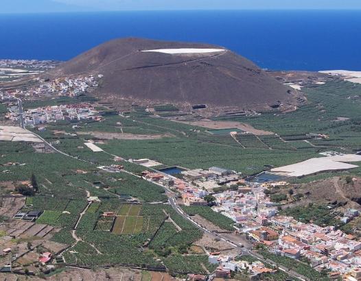
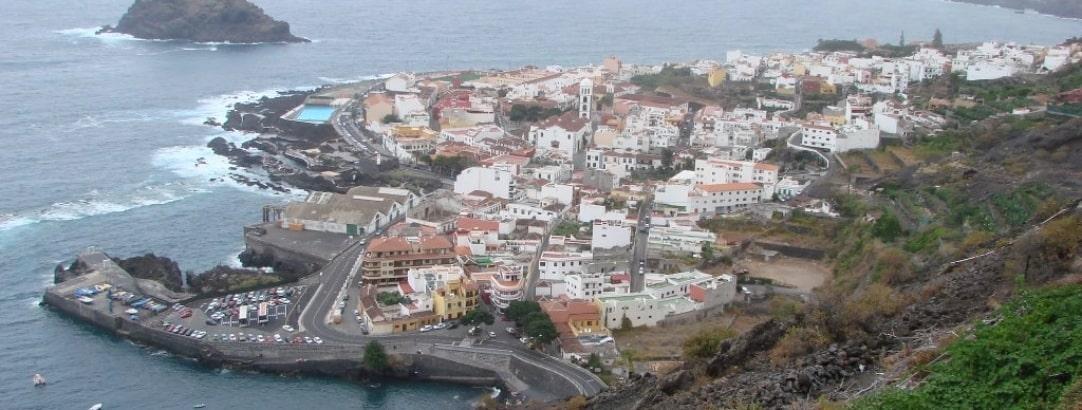
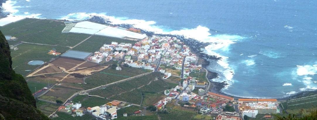
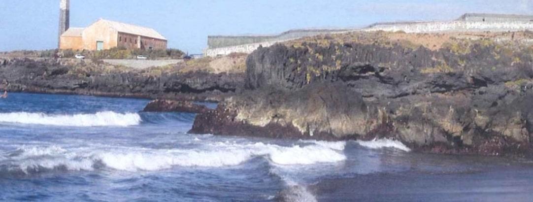
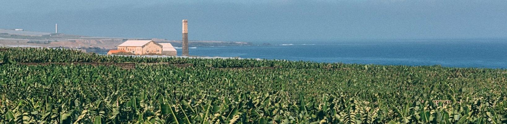
From that time the chimney and the facilities of another sugar mill are still preserved in the area, it is located in the middle of Punta del Risco de Daute. The farm is located with views of the sea, the coast and spectacular ravines in the area in the municipality of Los Silos within a rural enclave on the island of Tenerife. Today it is located in the middle of a traditional banana plantation, since at the beginning of the 20th century the expansion of this crop began, which became predominant in these low areas.

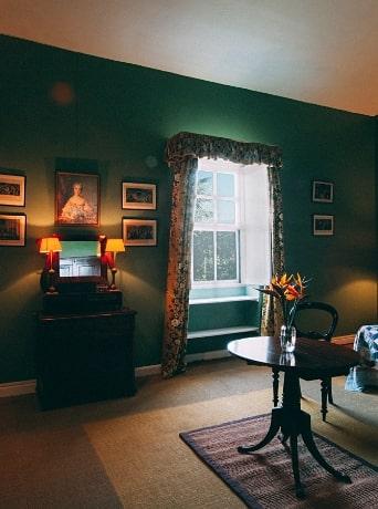
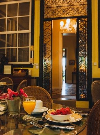
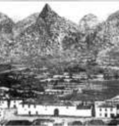
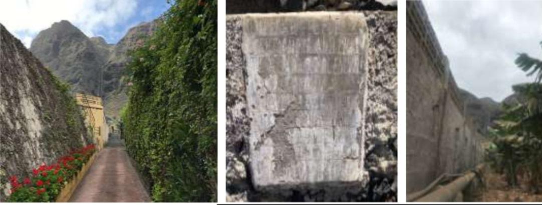
The constructions carried out in the middle of agricultural properties for the residences of the lords constitute the haciendas… Around the crops and rooms of the workers were deployed, without being integrated into the enclosure of the owners, since it was the true popular architecture that was inhabited by those. Over time, many of these haciendas have been transformed or have disappeared, although there are still good examples in the north of Tenerife. Some are U-shaped… haciendas were not the usual fixed residence of these wealthy families, who had their mansion as their habitual residence in urban populations.

Current exterior views of the Yellow House.

Description of the Canarian building.

The house is a colonial-style house that dates back to the mid-nineteenth century, as has already been said, is characterized by its wealth of wood, large tile roofs, projecting eaves, sash windows and a veranda or balcony covered and closed with glass that used by custom to sit at sunset, characteristic of coastal areas on the island of Tenerife and La Palma. We find ourselves before an architecture without architects, where masonry predominates, a patio with stills or cold storage… it is a functional, simple, sober house. The most abundant material is Canarian pine wood or tea, which, when impregnated with resin, acquires a reddish color and becomes incorruptible. For the tea to be good, the tree must be old, allowing thick boards to be obtained. The nails that were used were square and others were conical in shape with a thick head. The eaves and cornices are present in the house as a finishing touch to the façade and the patio to expel rainwater. The eaves are made of overlapping tiles as a continuation of the pitched roof. The two-story house, which served as an attic or rooms, has a rectangular floor plan, around a patio with a wooden gallery, living rooms, bedrooms and a kitchen.

Main facade of the Yellow House

The country manor house is a mixture of urban and rustic house. The dependencies forming separate constructions and at the time intended for services linked to an agricultural economy. It has an external staircase that ends in a small gallery. The staircase, always with handrails, is one body and leads directly to the second floor. One of the most widespread models of the Canarian house is the façade with symmetrical openings. The door goes in the center between two windows. The centered two-leaf door is preserved.

Interior of the Yellow House

Inside, the patio (current dining room) is a constant space in the Canarian dwelling, constituting the nucleus around which the lower and upper rooms are distributed… providing light and air, becoming the vital axis of the house. In the Canary Islands, the patio is located in the second bay of the house. The access door is always in the axis of the main one, placed in the center or on the right or left sides, regardless of the facades. In some, it is the porch that is at the same height as the access to the main entrance door, and the patio itself is at a lower level.

The plan of the patios is rectangular or more frequently, square. The appearance of some rings in the upper part of certain patios, suggests the placement of awnings that covered the space of those, as was used in Arab houses. The living room always occupies the front of the houses. It is lit by windows that overlook the main façade. The access door to the hall, with two leaves, is located in the gallery in front of the patio, which serves as an antechamber. Most of the furniture used in the houses of the Islands was imported, since the local industry was scarce. In place of the cabinets, cupboards built into the wall appear, divided into several compartments. The kitchen is always at the back of the main floor.

The lower rooms are arranged around the patio. The cellars are sometimes on the lower level in the basement or semi-basement…Light and air are supplied, apart from the door, by small windows…folding sometimes to facilitate ventilation. Inside the cellars, not only “wine and vinegar helmets and pipes” were kept, but also oil jars, fresqueras, etc. A staircase directly connects the backyard with the upper floor. On many occasions this patio is a simple vegetable garden. The two-story house used to belong to the most important families. In rural areas, they are located on large farms.

The Yellow House and its surroundings

The natural environment, in its upper part, is located in the Monte del Agua, a plant formation of extraordinary ecological value that extends to the top of the cliff by the headwaters of the ravines and constitutes one of the best laurel forests in the archipelago. It is preserved in its fullness in the deepest slopes, where the conditions are optimal. Its extraordinary humidity is key to its water resources.

In 1740, the engineer Antonio Reviere (Cartoteca del Servicio Geografico del Ejército 1740-43) described the Caleta as a place that “has water and houses scattered, you can only enter a boat at a time because it has cliffs to the right and left. of its entrance…in the map that it raises…the canal through which the boats enter, the entrance and exit in the trench, the house and tree that serves as a guide for the entrance and the old hermitage of San Andrés are outlined.

Ravines in Villa de Los Silos and laurel forest in Monte del Agua.

The festivities of La Caleta are celebrated on November 30 in honor of San Andrés, as well as in June where it is celebrated around the saint sailor, such as San Juan. To speak of La Caleta is to speak of the sea and boats, fish, shellfish, wine, sugar, bananas… All located in a neighborhood located in the heart of Isla Baja, between the municipalities of Garachico and Los Silos, who administratively they share this small territory. If we look at the current parish of San Andrés, limited to the east by the Barranco Hondo that descends from the municipality of Tanque and flows straight towards the sea. To the west, the Las Guardias ravine that descends from the Tierra del Trigo and runs perpendicular to the coast next to the Palma de Daute estate to end at the Gomero beach.

Aerial views of La Caleta de Interián

In this corner of Tenerife, three and a half kilometers in area, valuable endemisms of the Canarian flora have been preserved. The rains are scarce and do not usually exceed 25 liters per square meter per year, next to the sea. Temperatures range between ten and twenty-eight degrees centigrade, with hot summers and somewhat cold winters that at night the air lowers temperatures due to sea breezes, loaded with humidity. The strong and gusty wind appears sporadically in the area but when it does, it causes great damage, reaching 115 km/hour, especially the one that comes from the Pico del Teide, popularly called the Pico Wind. On several occasions he has not left a single bush (of bananas) standing. All this influences its vegetation formed by xerophytic plants: cardón, cardoncillo, tabaibas, always alive, balos; seedlings, mastic, orobal, cornical, heather, incense, palm trees, dragon trees, laurisilva, tiles, hollyhocks, which occupy ravines and shady slopes… plants typical of the Macaroresia region.

Location and plant richness in the Los Silos area

The design of the coastal coastline of La Caleta de Interián corresponds to that of a sinuous line…with hard breakers and noisy silences, to the empty sea, puddles and coves are discovered where young fish and shellfish specimens swim, until reaching the vicinity of the Daute Risco.

Approaching its history.

Few towns in Tenerife enjoy a past as rich as that of La Caleta de Interián, having to go back to 1506 to know its origin, the year in which the parish of San Pedro de Daute was created. “Within the head of the parish was the great estate of the Viña, a piece of land that the Adelantado Alonso Fernández de Lugo gave to Mateo de Viña according to what is recorded in the minutes of the Cabildo.”

El Cercado road in Garachico, San Pedro de Daute, in the background La Caleta de Interián

The beginning of its history “could” be the following: The Great Tinerfe, 2nd half of the 14th century, was the last of the menceyes or Universal Kings of the island, in his old age or upon his death, the revolution happened, due to rebellion of his sons, who divided the State into kingdoms of Icod, Tegueste, Adeje, Daute, Taoro, Abona, Anaga, Tacoronte and Guimar and the lordship of Punta de Hidalgo that the conquerors castellanized. The Adelantado Don Alonso Fernández de Lugo, godfather at the baptism of D. Diego (Pelinor) last mencey of Adeje, taken to Spain like other of his relatives, the Castilian monarch granting him the use of a coat of arms, him and his wife who took Lugo’s surname. He gave him the valley of Masca and its waters with more than a hundred bushels on the hills of Erjos. Rosmen second sovereign of Daute, they say they named him Gonzalo and others than Juan. The conquerors merged with the indigenous people and gave the gift to several Menceyes.

Map of Tenerife prior to the Castilian conquest and map after the Conquest

After the Conquest, ‘Los Silos’ was founded in the territories of the pre-Hispanic kingdom of Daute, located in the northwest corner of the island of Tenerife. Although there is no Foundation Act, its origin is closely linked to the Portuguese Gonzalo Yanes (Gonzalianes), owner of land in the place since the end of the 15th century. The name of Los Silos appears for the first time in an albalá (document) dated March 15, 1509. The origin of this nomenclature refers to three deposits (silos) to store grain built on the Gonzalo Yanes hacienda.

The Silos in Tenerife. Memory of the Silos.

The first settlers received data from land and water in the north of Tenerife from Anaga to Teno… The soil was altered to exploit it. Sugar cane and morals were planted for silk and cattle feed, vines and cereals. The mountain was drilled to get the water out of it, the slopes of culverts and canals were furrowed… and finally the banana crop that we see today in the caletero fields arrived.

In this place is La Caleta de Interián where the Yellow House is located. The origin of the second name of La Caleta “de Interián” must be sought before the beginning of the conquest of Tenerife. According to the documents, this part of the island was known to Adelantado Fernández de Lugo’s friends because they frequented it in search of cattle and slaves. Interián, a very old and noble surname in La Liguria (of the Italian Riviera) passed to the Canary Islands in the 17th century by Don Juan Interián, who was alderman of Tenerife in that century.

(Arms of the surname: In the field of sabers, a silver lion rampant, crowned with gold and gules.)

Coat of arms of Interián. Old photograph of Los Silos and Map of La Caleta de Interián in 1845- 1850

Mateo Viña, a Genoese banker, received several lands and waters in Daute from the Adelantado. His son Fabián Viña Negrón was born in Garachico in 1511, becoming mayor of the place. He was also Alderman of the Island of Tenerife. He built the castle of San Miguel in what is now Garachico, whose coat of arms hangs over the entrance door to this fortress, along with a cartouche bearing his name, and he founded the hermitage of San Andrés, in La Caleta de Interián in 1582. in 1623, on an embankment that dominated the cove or beach then known as Caleta del Viña and which would later be called Interián. In 1900 the hermitage was enlarged and in 1963 it was declared a parish by the bishop.

To put these lands into operation, the Viña family needed to resort to a loan…and this changed until it came into the hands of the Interián banker brothers, based in Malaga, descendants of Genoese. Faced with the scarce possibility, on the part of Viña, of making effective the debt contracted with the Interián brothers in 1516, they reach an agreement by which the hacienda is divided into two parts. In 1527, when the different leases ended, the property passed to the Interián family and from 1547 it began to be called Caleta de Interián, the name that is known today.

Church of San Andrés in La Caleta de Interián

In 1706 the Trevejos or Arenas Negras volcano spilled its lava over part of Daute, burned fields, blocked the springs that watered the vineyards, filled in the best part of the island and condemned many families from the northwest of Tenerife to forced emigration.

Drawing of the eruption of the Trevejo Volcano 1706

Already in 1765, the famous Nava aristocratic Tertulia met, which gave rise to the writing by Viera Clavijo of the Daute Gazette, the culminating moment of that ideological spirit within the social elites of the time. The handwritten newspaper Gaceta de Daute was a milestone in the history of communication in the Canary Islands and laid the foundations for the development of journalism in the islands.

With data taken from the private archive of the Cáceres family, descendants of the Interián and cochineal harvesters until 1842. “Plantations of prickly pears or nopales existed, until the arrival of the banana, on the farms of Casa Amarilla…also legumes.” In Tenerife and until well into the 20th century, there were English, Norwegian, German, Spanish, etc. merchant fleets. especially intended for the transport of bananas to the ports of Europe. Currently, banana exports have been reduced to the peninsular market.

The population of La Caleta must be found in the inhabitants of the Viña-Interián and González Yanes estates and in the complementary services they developed, both land and sea, derived from the sugar mills and later from the cultivation of vines and the marketing of wine. , also taking advantage of their free time to fish, shellfish and collect salt. Many of the activities have disappeared and some are practiced as craft entertainment. There were vendors who went through the towns knocking on the doors of the houses and offering the most varied genres. With a wicker or chestnut basket, sack or costal on the head, followed or not by a donkey.

La Caleta is configured as a small group of houses and rustic warehouse-warehouses built near the beach to attend to loading and unloading tasks, presided over by the hermitage of the apostle San Andrés. With the commercialization of the banana, which occurred around 1890 and the drilling of water galleries to attend to the cultivation, the land began to be dug up and stone terraces were erected to build the orchards.

In 1900 agreements were made for the urbanization of the caletero neighborhood by the municipal corporation, it was decided that the owners of the houses that had been built on municipal lots, without due authorization, proceed to measure the plot occupied by each house and force its owner to pay the amount of the lot. Many of the owners of the lots in 1902 began to present their duly drawn plans, at the same time that they requested a license to start the works on their home.

In 1913, Doña María Cólogan y Ponte 1873-1961, (portrait on horseback that exists in the house), married a grandson of the counts of Palmar, Luis LLarena and Monteverde, the marriage had three children: Luis, Elisa and Mª Luisa . The owner of the farm called “Casa Amarilla” exposes to the Garachico City Council the need to delimit her property from the municipal one, since her farm bordered, to the east, with municipal lots, the dividing line between both properties being a straight line that, from the northeast corner of another adjoining hacienda and ends at the seashore.

Portrait on horseback of Doña María Cólogan y Ponte.

This boundary was not marked by posts or landmarks and because it was convenient, both for the Town Hall and for the lady, that these witnesses be placed to determine said boundary in an unquestionable way. They left five and a half meters between one property and the other, which is the width that the street should carry and have in that place and extend to the sea. Formerly all the neighbors were considered to belong to a single town, that of Garachico until in 1927 the division arose; One part stayed in Garachico and the other depended on Los Silos.

Views of La Caleta de Interián belongs to two different municipalities, Garachico and Los Silos, but for caleteros their town is one.

In 1921, the Garachico and Los Silos road sections were still being built. Faced with these difficulties, it is not surprising that the ports and marine coves of the islands were used as loading and unloading stations for merchandise and passengers, with maritime transport prevailing over land. The inputs and outputs of agricultural products, livestock and manufactured items, were made directly through the coastal areas. To go from Garachico to Buenavista, you could go along the old or Royal road, or down to La Caleta along the road that led to the beach, continuing through the middle of the neighborhood and taking the public road that, starting from the Old Machine, passed by the Yellow House…

In September 1926, a lawsuit began between the municipalities of Garachico and Los Silos, for the limits in La Caleta de Interián. In reality the limits had been set much earlier in 1890, from the Correa ravine to the east it would belong to Garachico and to the west to Los Silos.

The sugar mills

In the 2nd half of the 16th century in the Canary Islands, sugar and its demand increased sharply, during this period production prices increased and in the first decade of the 17th century the mills declined.

The historian Rumeu de Armas recounts the invasion of 1586 where the mill was destroyed by pirates and many storms of wind and water in 1589, we do not know if it was repaired, the truth is that in 1612 the press houses for purging and honey were demolished. they continued to be carried out in other dependencies. In the twenties of the 17th century, other repairs were carried out late in the century, when only this sugar mill and Daute’s worked on the island, although the latter had a much lower production. The sugar destinations were Cádiz and Antwerp. The Garachico mill was conceived by Bartolomé de Ponte and his cousin Alonso, they must have had one pushed by circumstances and the disappearance of Interián, so that the canes of this hacienda, among others, would be ground in the new mill. The waters of both, which were united, remained forever, running in the middle of canals and ditches. The fixed date of completion was 1583 or early 1584.

Torriani (1560-1628), an engineer, architect and historian, as well as an Italian military geographer and cartographer, indicates the exact location of the mill on the map he draws of Garachico.

The main owners who ground their canes in the mill were: the owners of the Interián hacienda and other owners… around 1608 the mill stopped grinding and accelerated its disappearance.

The last of the Garachico sugar mills was located in the place known as the Old Machine, in our Caleta de Interián, a place close to the current Las Salinas school group. It was assembled in the year 1883 by Don Aurelio Padilla Domínguez, an emigrant who in Cuba, in the town of Matanzas, held the position of foreman of a sugar mill. Aurelio had founded in Havana, the company “Capote, Padilla y Compañía”, dedicated to the exploitation of sugar and liquor on the island of Tenerife. The company would make the products with the “Teide” trademark.

The Teide mill was the last opportunity for Isla Baja to recover the old sugar industry, although sweet cane had never disappeared from the area, nor did it disappear this time. At the beginning of the 20th century there was another attempt to exploit sugar cane by the English company Igller, which put into operation the mill that concerns us, near Sibora, near the “Agua Dulce” beach.

It is the set formed by the stone chimney, more than 25m high, and two naves currently used for agricultural activity, arranged perpendicular to each other. In it, as D. Cheo Velázquez mentions and to whose book I refer those who want to go deeper, the machinery that the Teide sugar mill (Casa Amarilla) had was used. Its location and harmonious layout have made this old sugar mill a reference point on the coast of the Daute region.

His representative, Mr. Jorge B. Parke French, of English nationality, a well-integrated character in Silos society at the time, had arrived in Los Silos in 1891 when he was only 23 years old to work as a bookkeeper in the sugar industry. In the first stage of it he stays in the house of La Casa Amarilla. Taking advantage of its proximity, he gave his camel rides to the coast, hence the name of the “Charco del Inglés”. The locals took advantage of his musical knowledge, since he was a member of the English Royal Guard Band and took charge of the formation and direction of the Los Silos Philharmonic Society “La Unión” in 1899. On February 15, In 1903, Jorge Parke drew up the first Statutes that would regulate the formation of this company, meeting with a group of neighbors who were in charge of drafting them. He knew how to combine his vocation with work in the Daute factory.

Puddle of the English. Don Jorge B. Parke French and “La Unión” Philharmonic Society 1899

They set up the industry in a place near Las Siboras de Los Silos, based on a salt installation, whose remains can still be seen next to the Daute dock, which was built for the service of this factory. It used the same machinery, boilers and presses that the “Teide” (Yellow House) sugar mill had. At present, its location is distinguished by keeping its tall and elegant tower-chimney vertical, which has become another of the symbols of the municipality of Aregume (Los Silos). The cane plantations for this industry were in the same area as those of Alonso Fernández de Lugo or Gonzalianes and those of Don Aureliano Padilla.

Popularly known as La Torre, its tall chimney, visible from any part of Isla Baja, has become an emblem of Los Silos. Due to its landscape values ​​and its suggestive view of the sea, sitting on a pronounced coastal ledge next to the old coastal path that leads from La Caleta de Interián to Las Siboras, it is also one of the most interesting examples of industrial architecture in Tenerife in late nineteenth century. It dates from 1869-1890 and was built within the Daute estate by The Ycod & Daute Estate Company Limited, a trading house-established in the city of Manchester under the name of Lathbury and Company- which installed around the same time (1890) a similar factory between the municipalities of Guía and Gáldar, on the island of Gran Canaria.

Erigida sobre unas antiguas salinas existentes en este lugar, constaba de dos amplias naves-con tejados a dos aguas sobre techumbres de vigas y tirantes de madera de considerable escuadría -dispuestas perpendicularmente y una chimenea troncopiramidal, fabricada con piedra molinera en sus dos tercios inferiores y tosca amarilla en el último, casa de medianeros o colonos y estanque accesorio para la máquina azucarera traída desde Liverpool, en principio al ingenio de La Casa Amarilla y luego reubicada en la hacienda de Daute. Junto a ella se halla el muelle de Daute, desembarcadero de mampostería construido por la misma compañía para las operaciones relacionadas con la industria de la caña dulce. Sin embargo, superada la crisis como consecuencia de la situación bélica internacional(La 1ª Guerra Mundial), el plátano remplazó definitivamente a la caña dulce y con la desaparición de la máquina azucarera-trasladada a Portugal- el edificio y su  muelle anexo fueron reutilizados para empaquetado de la fruta y exportación de bultos; función que sigue cumpliendo en la actualidad.

“Fresh water” beach in Los Silos.

Fishing by boat, rod or rod, pulping and browning, has always been very good for the caleteros. The salt produced in the neighborhood has traditionally been used to salt fish to flavor cheese and milk… In this place, tourism as such is a very recent phenomenon and only the “Yellow House” and some other accommodation in the neighborhood of San Andrés.

The neighborhood of La Caleta has a network of paved and clean streets in which the houses are lined up with their well plastered masonry walls painted in cheerful colors. The squares, apart from the one located next to the parish and called San Andrés, the town has two more in Los Silos, one also called San Andrés located in the vicinity of El Faro and another, very recent, with trees and landscaped, unbaptized, between the vicinity of Las Salinas and Casa Amarilla, currently. Very close to this square is the pond or dam of the Casa Amarilla, which has a sign that reads: “Begun in 1941 and finished in 1943. It carries the amount of 56,297 pipes” (15). Also inside the farm there is another sign referring to the canal that collects the waters from Los Silos (Monte del Agua) where it reads: “Begun on September 1, 1943 and finished on January 22, 1944 commissioned by Gregorio Ramos, teacher Rafael Palenzuela and Fermín Afonso. Canal meters 1600, P. (peons) Ángel Acosta and Rafaelito, Claudio López and Ruperto López. Another curiosity of the La Casa Amarilla farm is that the Interián soccer field was located in its orchards near the coast, there is only the access gate to said field, today that banana orchard on the farm is known as the “ garden of old football”.

Cartouche pond and channel in the “Yellow House”.

In conclusion, the actions that have been carried out in the house contribute to its enhancement by providing it with a new activity and therefore its survival in the history of the place, thus protecting the historical legacy.

Inés Hernández Pérez, graduate in General History, Art History section.

Bibliographic references

– Certification of the Property Registry of Icod de los Vinos.

– Great Encyclopedia of Art in the Canary Islands. Canary Popular Culture Center. Tenerife, 1998.

– Martin Rodriguez Fernando Gabriel. Canarian domestic architecture. Culture Hall of Tenerife, 1978.

– Canaria-Gevic.net., Great virtual encyclopedia Canary Islands.3. country world. The traditional house.

– Notices Journal 2014, Moisés Pérez Natalia Torres, Los Silos.

– Hernandez Gonzalez Manuel. Tenerife Historical and Cultural Heritage. “The Silos”. Editorial Rueda, Madrid, 2002.

– Diaz Dorta Nicholas. Explanatory notebook of the genealogical tree of the indigenous Royal Family of Tenerife and its most distinguished descendants, 1913, Santa Cruz de Tenerife. Donated by the author to the Municipal Museum of Santa Cruz de Tenerife. https://www.ecured.cu/Los_Silos.

– General notes on the history of Garachico. Aula de Cultura de Tenerife, cultural association friends of Garachico in Venezuela. Santa Cruz de Tenerife, 1994.

– of Zárate and Cológan Melchor. Genealogy and Heraldry of surnames of the archipelago, (cited in the nobility of the Canary Islands). La Orotava, 2003.

– Colonel Soriano Carlos. The Clogans from Ireland to Tenerife (1684-2010), Canary Islands 2010.

– Velazquez Mendez Jose. The Cove of Interian. Hon. City Council of the Villa and Port of Garachico and Hon. City Council of Los Silos, La Laguna Tenerife, 2001.

– Rodriguez Yanes Jose Miguel. The sugar mills of the Ponte 1550-1610, pages 28-41 Gaceta de Daute I Islas Canarias, 1984.

– Acosta Garcia Carlos. Los Silos: Notes for the history of the Villa. Santa Cruz de Tenerife, distinguished City Council of Los Silos, 1988.

– Foundation: “La Unión” Philharmonic.

– Perez Morera Jesus. The fruit of the land the banana in the Canarian identity: the banana, the taste of art. Ed. Association of Canary Islands Banana Producer Organizations. Spain, 2006.

– González.-Sosa Pedro. Guide to Gran Canaria history of the Machine and the cultivation of sugar cane in the 19th century, from the City Council of Santa María de Guía, 2004 p. 81-89.

This site is registered on wpml.org as a development site. Switch to a production site key to remove this banner.